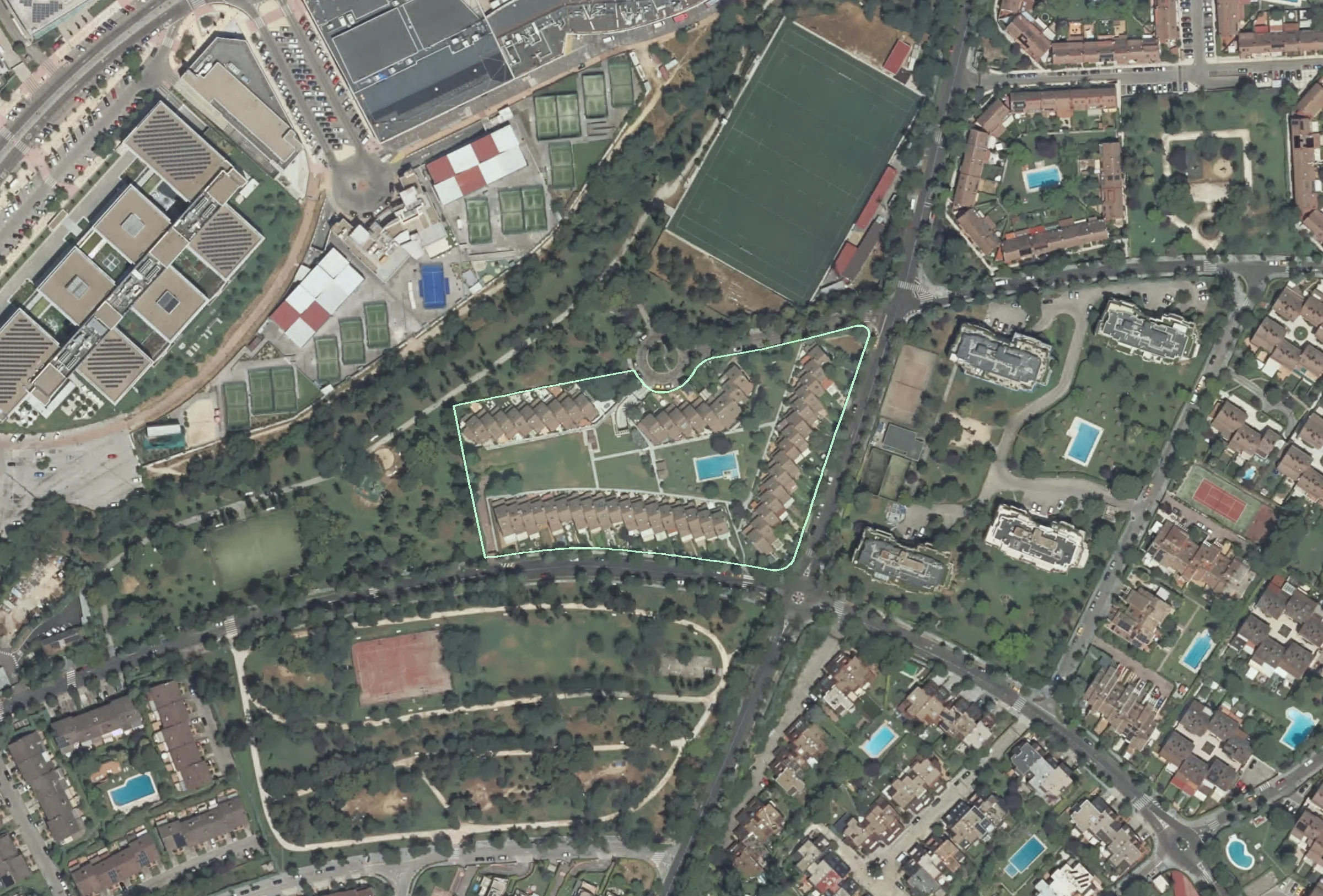
Official 2025 aerial view of Los Arrayanes, with the current communal parcel outlined

LOS ARRAYANES · EL SOTO DE LA MORALEJA

NARDO01

A home. A community.
A landscape rewritten.

Follow one address through seven decades of aerial photography, from open land to a garden neighborhood.

ACTUAL GOVERNMENT AERIAL · 2025Current shared parcel outlined. Not a private garden boundary.
THE HOME221 m²Registered construction · includes common share
THE COMMUNITY51 homesRecorded on the communal cadastral parcel
THE SHARED SITE1.48 ha14,777 m² · not the plot of one house
THE VISUAL ARCHIVE11 surveys1956–1957 through 2025 · government imagery

01 / THE TIME MACHINE

Same place.
Another world.

Move the divider. Change the year. Watch the houses and the neighborhood appear.

↳ Aligned official imagery. No reconstructed or AI-generated history.
→
1980BEFORE THE HOMES
2025LATEST RETRIEVED SURVEY
‹ ›
Current communal parcel · not individual house boundaries
IGN / Comunidad de Madrid · Catastro geometry

ⓘ The 1984 survey already shows the housing rows; the cadastral building year is 1985. These describe different milestones—not a contradiction. No exact completion or occupancy date is established.

02 / READ THE HOUSE

One address.
Not the whole estate.

The most important distinction in the records: No. 1 is an individual cadastral unit inside a larger shared development.

THE INDIVIDUAL HOME 01 / 51

Calle del Nardo, 1

Los Arrayanes · Alcobendas · 28109

221 m² registered

182 m² is classified as residential construction. The remainder is parking and an allocation of common elements. None of these figures is a measured usable-floor-area survey.

Official cadastral record ↗
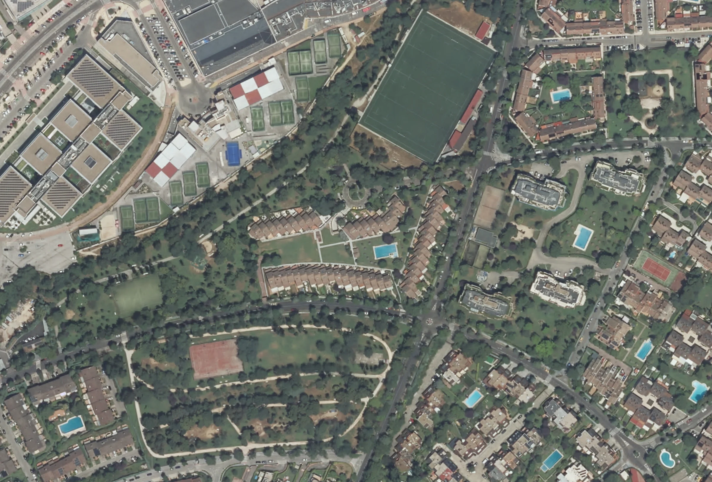
Aerial setting of the Los Arrayanes development

THE SHARED DEVELOPMENT

Los
Arrayanes.

51registered dwellings
14,777m² communal parcel

The repeated housing rows enclose a shared garden and pool area. The lime outline in the time machine follows the development’s present cadastral parcel.

See the communal site ↗
KEEP THE SCALES SEPARATE

Nardo 1 is the home. Los Arrayanes is the 51-dwelling community. El Soto de la Moraleja is the wider neighborhood and conservation entity. Their boundaries and histories are not interchangeable.

03 / LAYERS OF HISTORY

More than
a building date.

Photographs tell us what changed. Official records and contemporary accounts tell us when—and what we still cannot know.

Documented Visually observed Reported

04 / FOLLOW THE EVIDENCE

Real images.
Open sources.

Every dated image comes from a government mapping service. Every milestone is labeled by evidence type.

Download the evidence ledger ↓
What this app does—and does not—establish +

    Research is property-focused. No residents’ names, ownership profiles, private security details or invented sale prices are included.